Warning where the Big One will hit
Thursday 8 December 2011
UC Berkeley is partnering with two other universities, a philanthropic foundation and industry to conduct earthquake research that could lead to a warning system. People could then have time to dive for cover, and transportation and utility systems could shut down operations.
A major fault ruptures somewhere along the 70-mile-long Hayward Fault. But where? Is the break at just one point along the restless slab, or many?
Answers are crucial to predicting where the worst shock will hit and how much damage it will cause. The underground details can provide a precious five- to 30-second warning between the time a temblor is detected and when its destructive energy reaches the surface.
But seismology cannot yet supply the data. Scientists don’t adequately understand the basic physics of the fault-rupturing that triggers the largest quakes — magnitude 7 or greater. And without that insight, they can’t warn citizens, utilities and industry where or what destruction is on its way.
An unusual alliance between a philanthropic foundation, universities and industry has launched a three-year research effort to advance this knowledge and develop a prototype seismic and GPS-based network to pinpoint sites of rupture within seconds.
The Gordon and Betty Moore Foundation provided $6 million over three years to three West Coast universities to refine the understanding of fault dynamics and develop the prototype system. The long-term goal is to provide crucial early warning along the entire West Coast.
“I am confident that this research will allow us to develop a truly effective prototype,” says Richard Allen, director of the UC Berkeley Seismological Laboratory. “With that demonstration, we would seek federal funding for a full-scale West Coast early warning seismic network.
“This would be tremendous progress, and could provide in some cases as much as 30 seconds of advance warning to cities, businesses — to millions of people.”
Allen stresses that the goal is not predicting quakes themselves, but rather the location and likely extent of damage of quakes within a few seconds after the deep-earth rupture.
Caltech and University of Washington seismologists join Berkeley in the research project.
Google.org and Deutsche Telekom's Silicon Valley Innovation Center are providing financial support for developing the prototype. They also will be at the receiving end of early warnings in the “practice” phase of the project. The companies hope that if fully implemented, the system could reduce damage to commercial operations when a major quake hits.
Developing a quicker, more accurate warning system can alert individuals to dive for cover, give transportation systems and utilities time to shut down operations and allow delicate procedures — from surgery to precision manufacturing — to be halted before a destructive quake arrives.
“Our goal is faster estimation of the precise location and likely degree of damage,” Allen says. “We need to limit destruction, but also limit false alarms so communities and businesses are spared costly emergency precautions.
“If we can predict that the real damage from a rupture along the Hayward Fault won’t hit, say, San Jose, but instead will severely jolt a city 20 miles farther north along the fault, that could save resources and lives.”
Faults are fractures in slabs of rock beneath the surface, sometimes as deep as 10 miles down. When stress builds up between rock on opposite sides of a fault, a rupture can occur, releasing a tremendous amount of energy. The rupture can be small or large, and it can be isolated or can trigger a rapid series of subsequent ruptures, Allen explained.
Whether a rupture will trigger other slippage farther along the fault influences tremendously the location and extent of surface damage.
Researchers already know the typical pattern of energy released by quakes. Seismographs first detect a burst of energy, known as the P-wave, as it heads toward the surface. P-waves carry relatively little energy and rarely cause damage. They are followed by the so-called S-waves, which reach the surface about two seconds later and carry the slipped fault’s true destructive force.
Quakes of magnitude 6.5 or less usually arise from a rupture in only one location along a fault — its epicenter. Seismologists can confidently predict that damage will occur in regions closest to the epicenter.
But in quakes of 7.0 or larger — “the big ones” — the rock slabs on opposite sides of a fault can slip and slide in a number of regions. In this case, surface damage is more dependent on the distance from the fault than proximity to the first slip, the epicenter.
“We need to track the fault rupture as it happens and update our warnings as necessary,” Allen stresses.
The new project’s basic research is two-fold: to refine current understanding of how rupture patterns affect the location and amount of damage, and to use this understanding to predict location of major damage seconds or tens of seconds before they occur.
Active faults are often five to 10 miles below the surface – beyond the reach of any imaging technology, Allen explained. Unable to see the different sites and types of movement, researchers will primarily focus on refining computer models to more accurately reflect the key physical triggers and constraints at play along a deep-seated rupturing fault.
The trick will be to “synch” detailed records of past quake damage with the models of fault dynamics. Then seismology will reach the goal of predicting the trajectory of the world’s worst earthquakes.
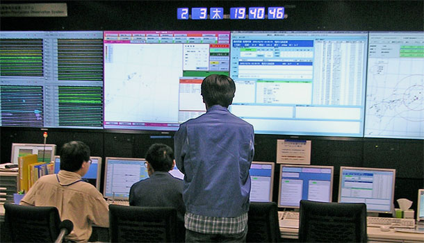
Photo at top of page: The control room at the Japanese Meterological Agencywith its earthquake early warning system. Photo by Richard Allen